Completed as University coursework, this report required researching and writing about four types of natural infrastructure in an urban community. All photos are taken by Lindsey McDonald. All charts and maps are created by Lindsey McDonald in QGIS with data from Calgary Open Data Portal.
Sage Hill community Report
explore four types of 'natural infrastructure' and how it affects the surrounding community of sage hill
Introduction
Located in Northwest Calgary, Sage Hill is an up-and-coming residential community with a population of approximately 8,000 people. Its borders are defined by 144 Avenue NW to the north, Shaganappi Trail NW to the west, Symons Valley Parkway to the south, and West Nose Creek to the east. Development began in 2008, and is on-going, with new single-family and multi-family homes currently under construction.
While the majority of the land use is residential, there are three commercial centers: Sage Hill Quarter, Sage Hill Crossing, and Sage Meadows. Residents of Sage Hill have access to all amenities. There are no major parks, but there are multiple ball diamonds, playgrounds, soccer fields, and recreational pathways. There is extensive greenspace, including natural ravines snaking their way through and joining with storm ponds. Directly north of the community is agricultural land, soon to be developed as the community of Glacier Ridge.
An overview map of Calgary, Alberta, Canada, with the northwest community of Sage Hill highlighted.

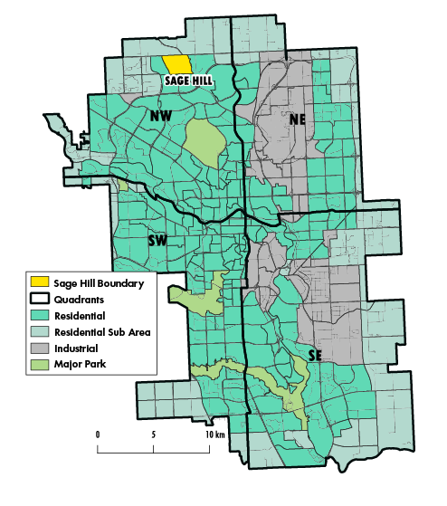
Calgary, Alberta depicted by community type. Sage Hill is highlighted to show its general location within the city. (MAP CREATED WITH QGIS, DATA FROM CALGARY OPEN DATA PORTAL)

A view of the ravine in Sage Hill, Calgary.
A pie chart showing the breakdown of natural infrastructure in Sage Hill. Paved, exposed dirt, and construction 40.1%; grassland 24.8%; water and streams 0.4%; manicured grass 22.1%; forest and trees 0.1%; other 12.5%.

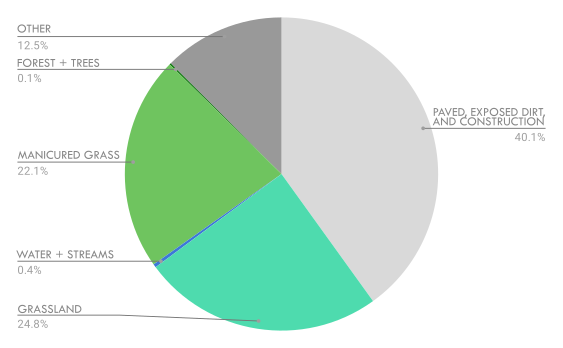
Breakdown of the types of land cover in Sage Hill by percentage, total land area represented is 376.76 hectares. (DATA FROM CALGARY OPEN DATA PORTAL)
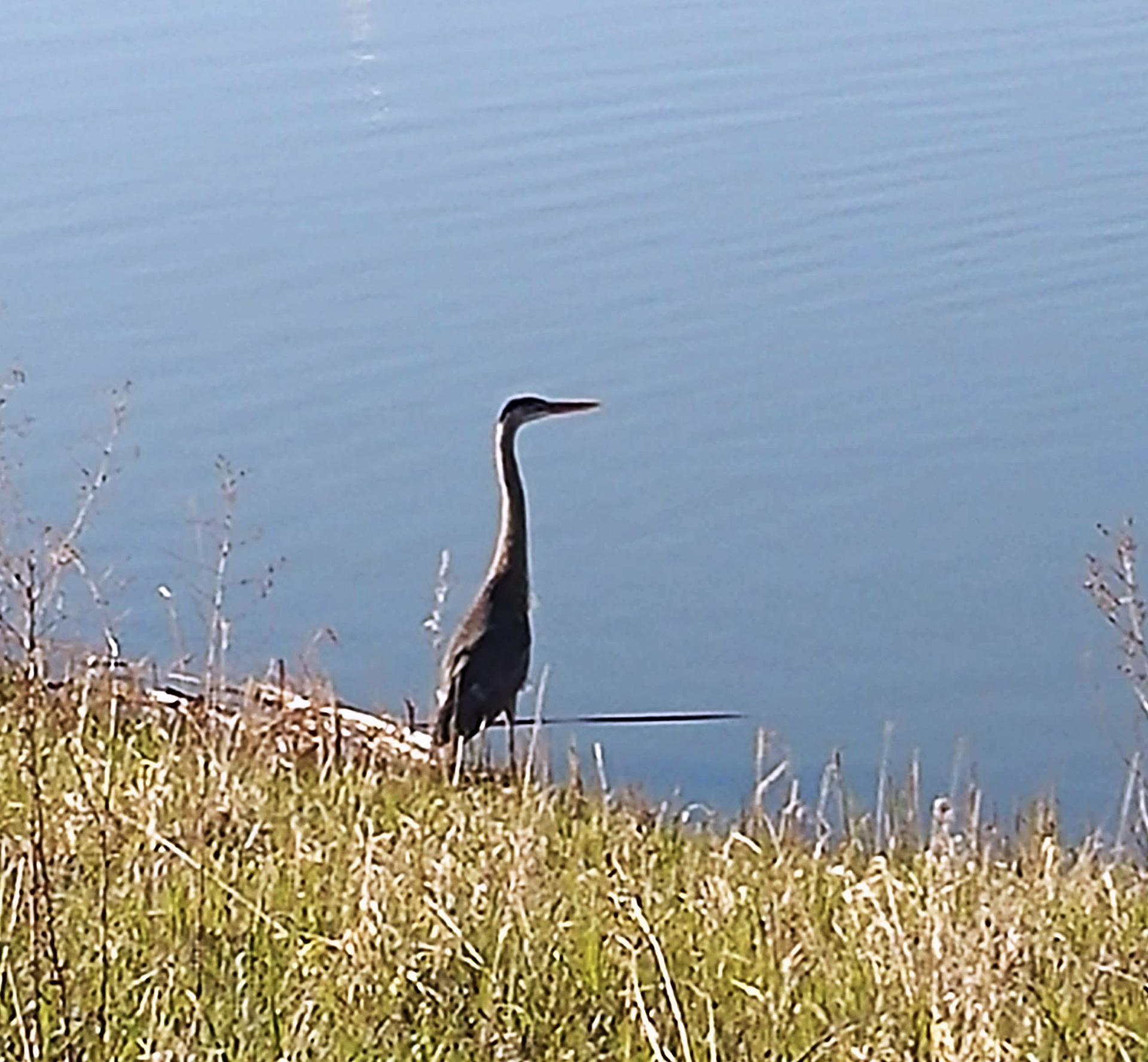
LAND USE AND NATURAL INFRASTRUCTURE
The community covers nearly 377 hectares, of which 40% of the area is paved, exposed soil, buildings, or currently under construction. The remaining 60% is broken into grasslands, wetlands, manicured grass, public trees, storm ponds, streams, and various other land uses. Ecosystem services provided by these natural infrastructure features are categorized into provisioning, regulatory, cultural, and supporting services (Millennium Ecosystem Assessment, 2005).
The notable features that this report focuses on are the storm ponds, naturalized grasslands, public street trees, and manicured turf grass. These are the most prominent aspects of natural infrastructure within Sage Hill. Selected ecosystem services are highlighted, with a special focus on aspects that help mitigate climate change. 
All data is compiled using QGIS 3.14 analysis tools in conjunction with maps of Calgary, all statistics are estimates. All natural features identified are based on observations by the author, a Sage Hill resident since 2014. One exception is all tree data, which was calculated via QGIS 3.14 and Microsoft Excel. Plant identification via Common Coulee Plants of Southern Alberta (Bain et al., 2014) and Wild Flowers of Alberta (Cormack, 1967).
Sage Hill storm pond at dusk.
Storm Ponds
Covers less than 2 hectares. 
Murky water ponds with emergent vegetation, waterfowl,
and small fish

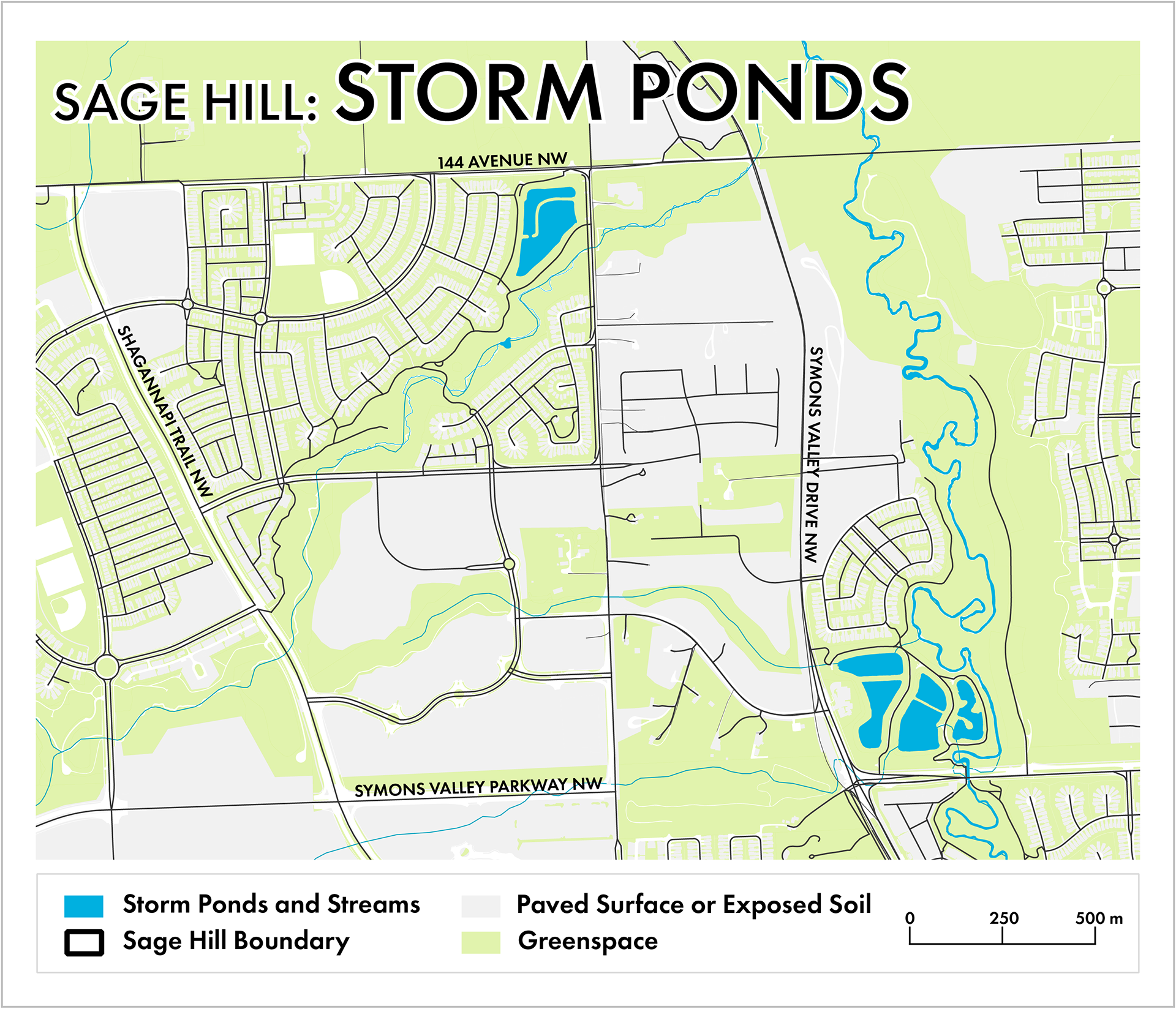
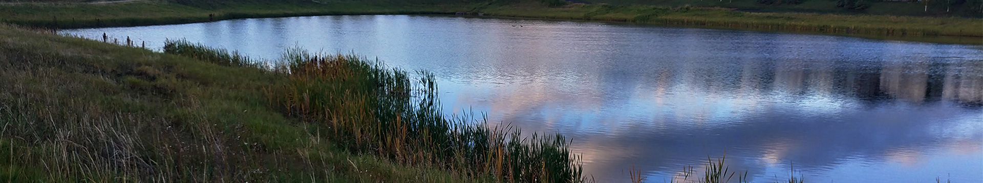
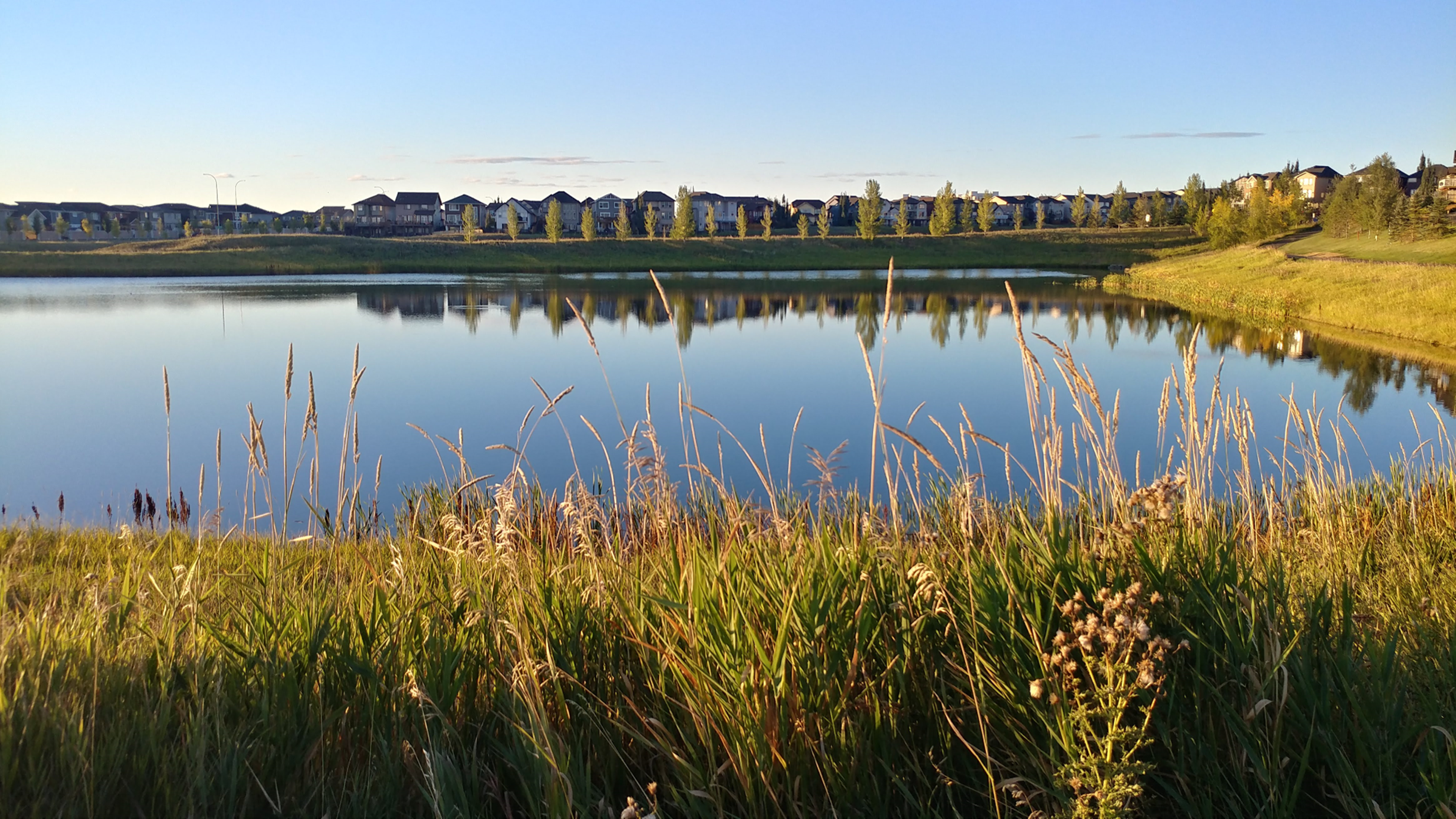
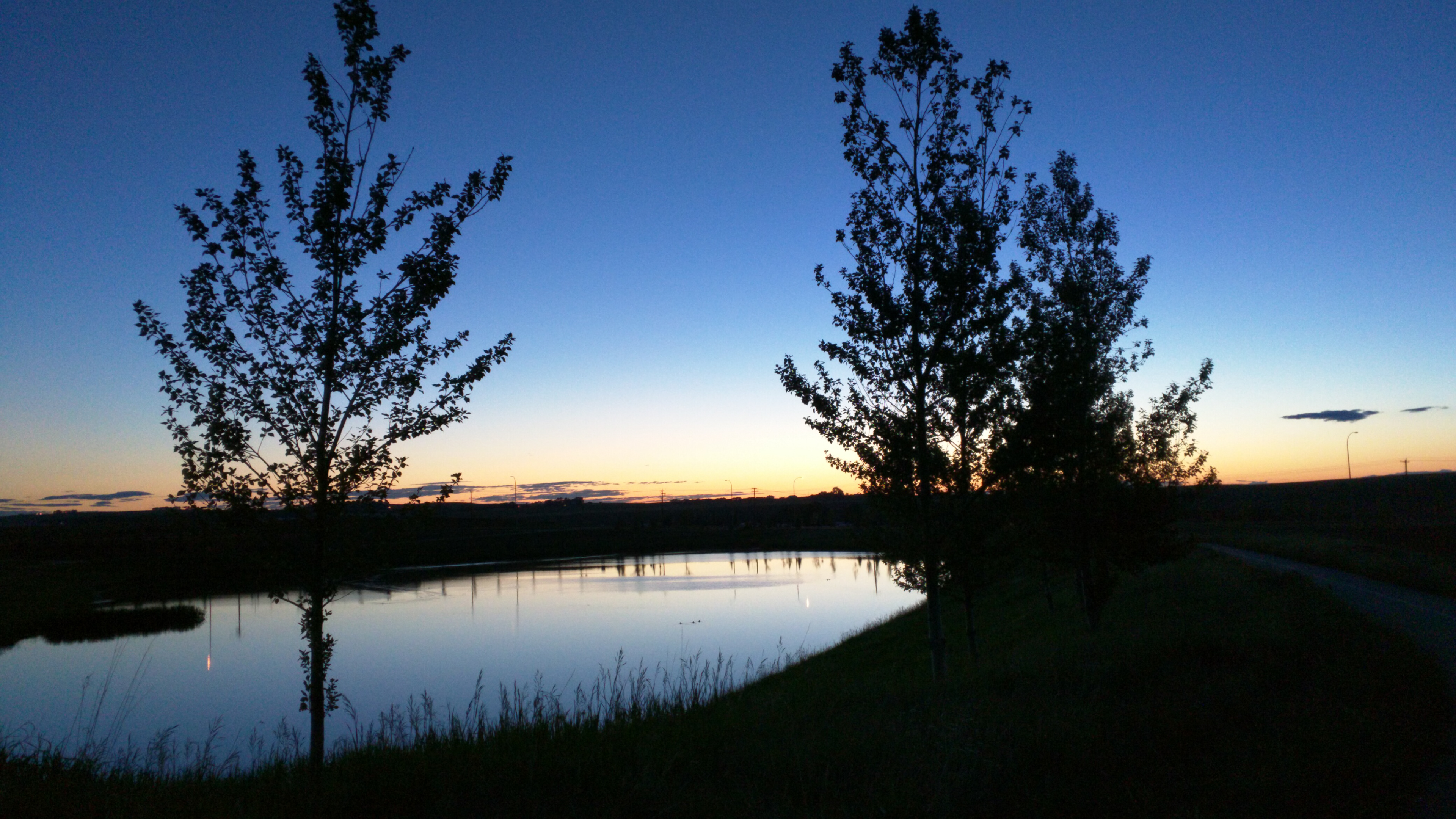
The community contains two areas with major storm ponds which are connected by streams and creeks. DATA FROM CALGARY OPEN DATA PORTAL 

REGULATING SERVICES
Ponds store runoff water from rain and snow melt and release it back to the environment slowly. 
Ponds helps remove pollutants by allowing them to settle to the bottom of the pond, or be processed by emergent vegetation like cat tails (Typha latifolia) (Gómez-Baggethun & Barton, 2013).
Less pollutants in the water result in less work for water treatment plants, which can increase efficiency (Keeler et al., 2019). 
SUPPORTING SERVICES
Birds are attracted to the ponds, with regular sightings of Great Blue Heron (Ardea Herodias), Canada Goose (Branta canadensis), American Coot (Fulica americana), Wilson’s Snipe (Gallinago delicata) and many varieties of other waterfowl. 
CULTURAL SERVICES
Wildlife sightings help a community feel connected to nature and improve emotional well-being (Chiesura, 2004).
DISSERVICES 
Both flora and fauna contained can be considered nuisance species, such as coyotes and invasive noxious weeds (Keeler et al., 2019). 
Grasses can pose as a fire risk during very dry seasons, and some may consider it an eyesore (Keeler et al., 2019)
CLIMATE MITIGATION 
Various plant life in the coulees allow for carbon sequestration, by using photosynthesis to fix carbon into their structures. The untouched nature of naturalized grassland allows plant matter to build up and incorporate more carbon into the soil (Monteiro, 2017). 
Erosion control and water retention can help mitigate damages caused by extreme weather events (Gómez-Baggethun & Barton, 2013).
POTENTIAL THREATS 
Homeowners adjacent to the greenspace sometimes mow wild areas or dump waste.
Street Trees
Over 2600 publicly owned trees. 
More than 40 types, 93.5% deciduous and 6.5% coniferous trees.

The top five most abundant trees are: Brandon Elm (Ulmus americana 'Brandon'), 701 trees; Trembling Aspen (Populus tremuloides), 524 trees; Green Ash (Fraxinus pennsylvanica), 234 trees; Schubert Chokecherry (Prunus virginiana 'Schubert'), 224 trees; and Mayday (Prunus padus), 151 trees.

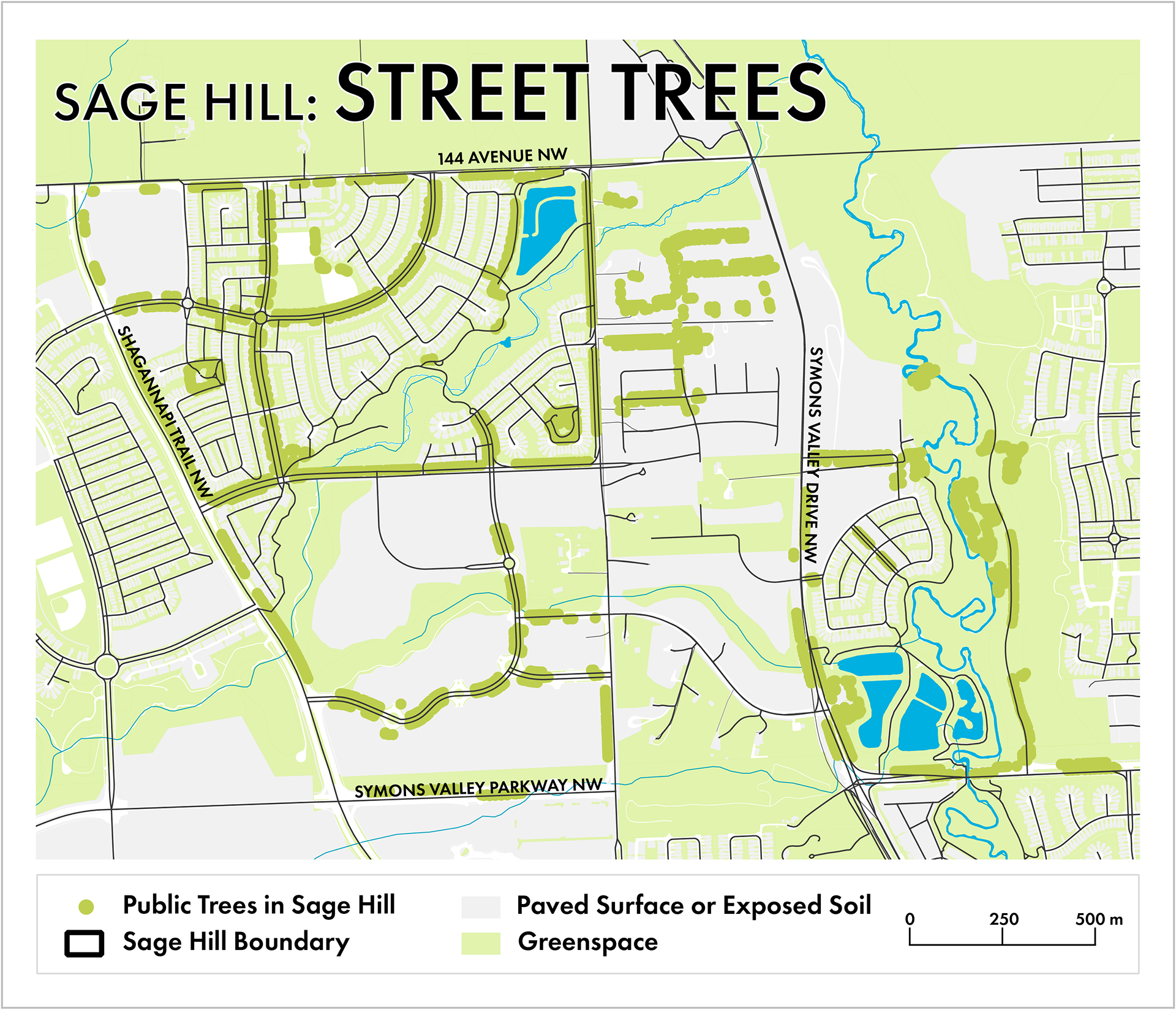
The community has trees planted along the boulevards and along sidewalks. DATA FROM CALGARY OPEN DATA PORTAL

​​​​​​REGULATING SERVICES 
Trees help provide continued access to clean air by regulating the amount of particulate matter suspended in the surrounding air (Keeler et al., 2019). 
SUPPORTING SERVICES 
Helps maintain biodiversity by providing habitat and a variety of food sources for wildlife (Salmond et al., 2016). 
Fruit bearing trees such as crab-apple and cherry varieties make up approximately 16% of all public trees in Sage Hill. These trees are an important food source for birds such as American Robin (Turdus migratorius) and House Sparrow (Passer domesticus) (Belaire et al., 2014). 
CULTURAL SERVICES 
Trees contribute to masking road noise pollution, and increase instances of natural sounds that can increase human happiness (Salmond et al., 2016). 
Children have turned the few large trees into their own playground, building ladders and swings. The trees have become a meeting place, and a well known landmark throughout Sage Hill.
DISSERVICES 
Trees produce volatile organic compounds which can lead to ozone and smog (Keeler et al., 2019). Leaf litter, fruit, and seeds must be cleaned up seasonally, they can be considered an eyesore and cause increased maintenance costs (Keeler et al., 2019).
CLIMATE MITIGATION 
Trees sequester carbon through photosynthesis, which allows trees to pull carbon dioxide from the air and fix it in their structure for long-term storage (Salmond et al., 2016). Trees next to sidewalks add shade, allowing locals access to cooler areas on hot days.
POTENTIAL THREATS 
Wildlife feed on young trees can reduce their lifespan and increase maintenance costs.
Few coniferous trees are present on the boulevards.
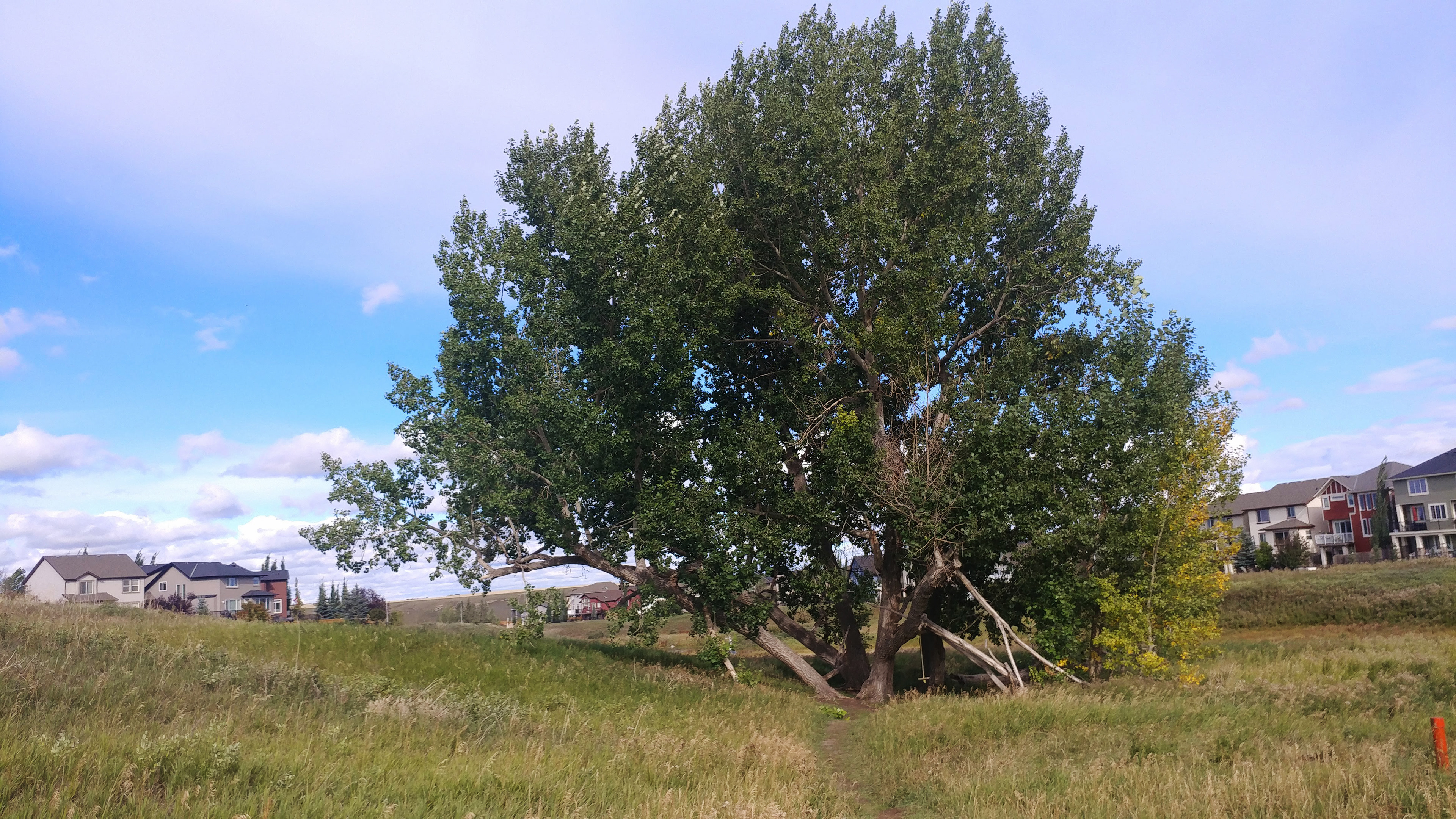
This is the original big tree in the neighbourhood.
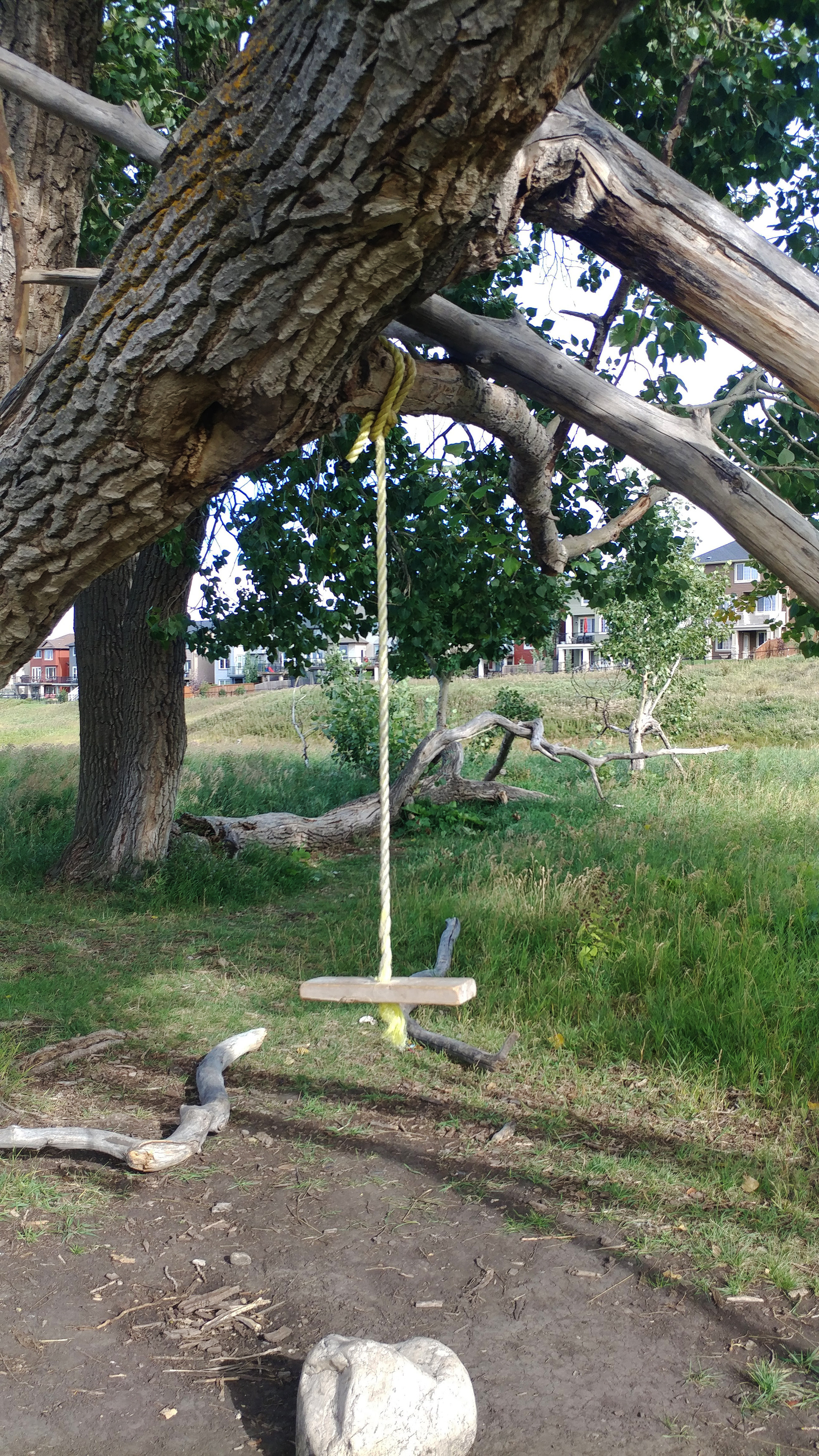
This is a close up of the "big tree" that the neighbourhood kids play in.
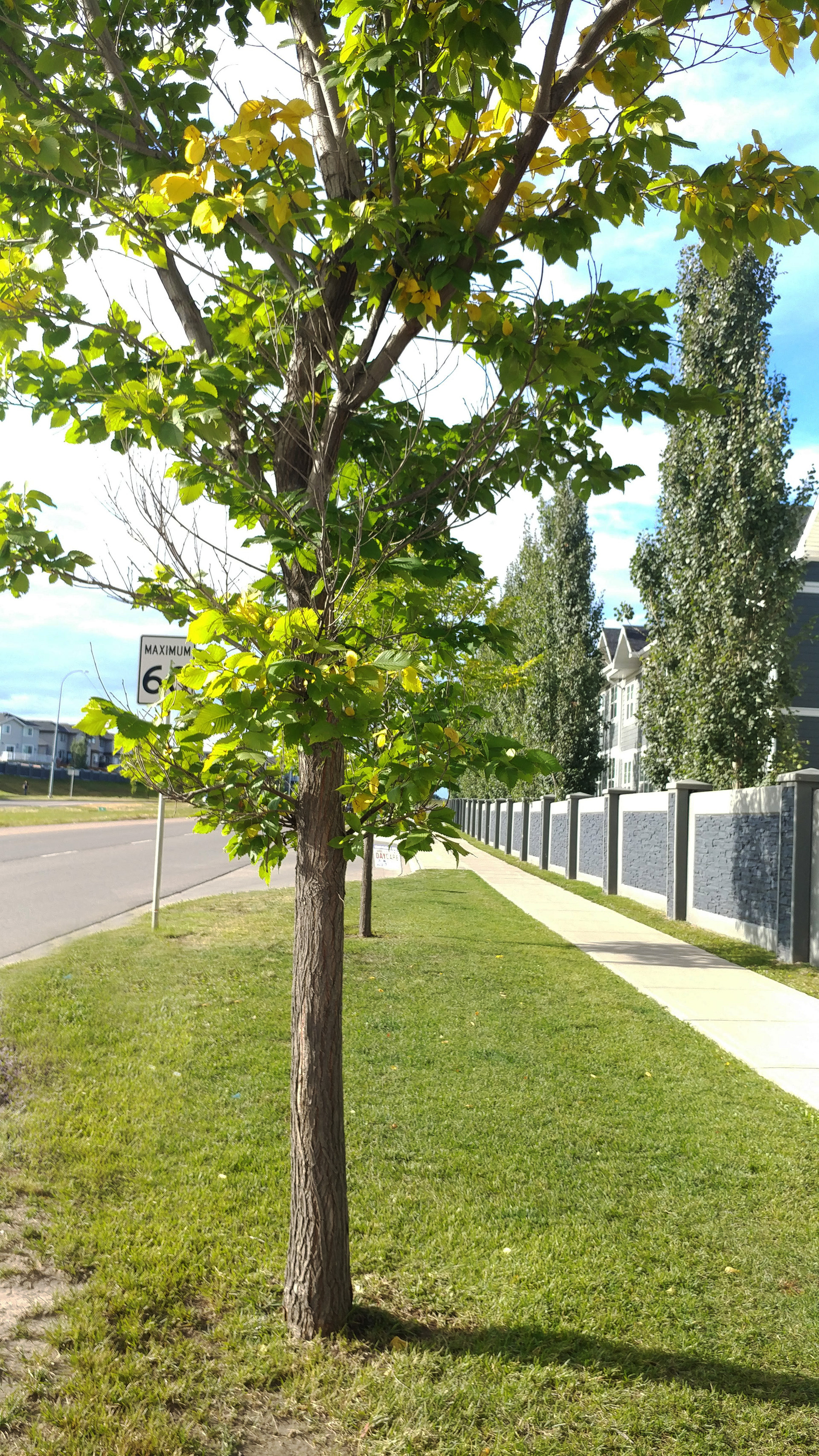
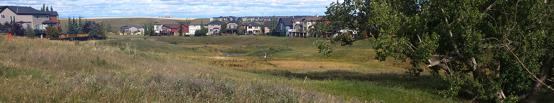
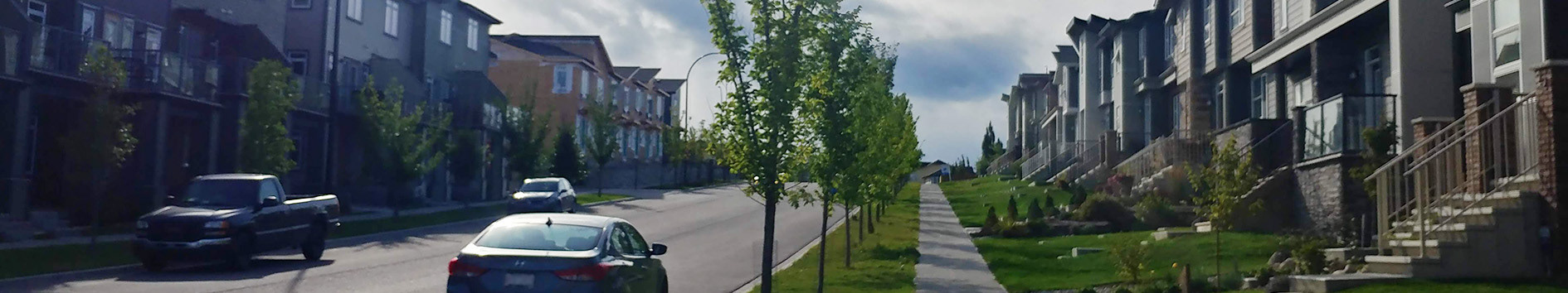
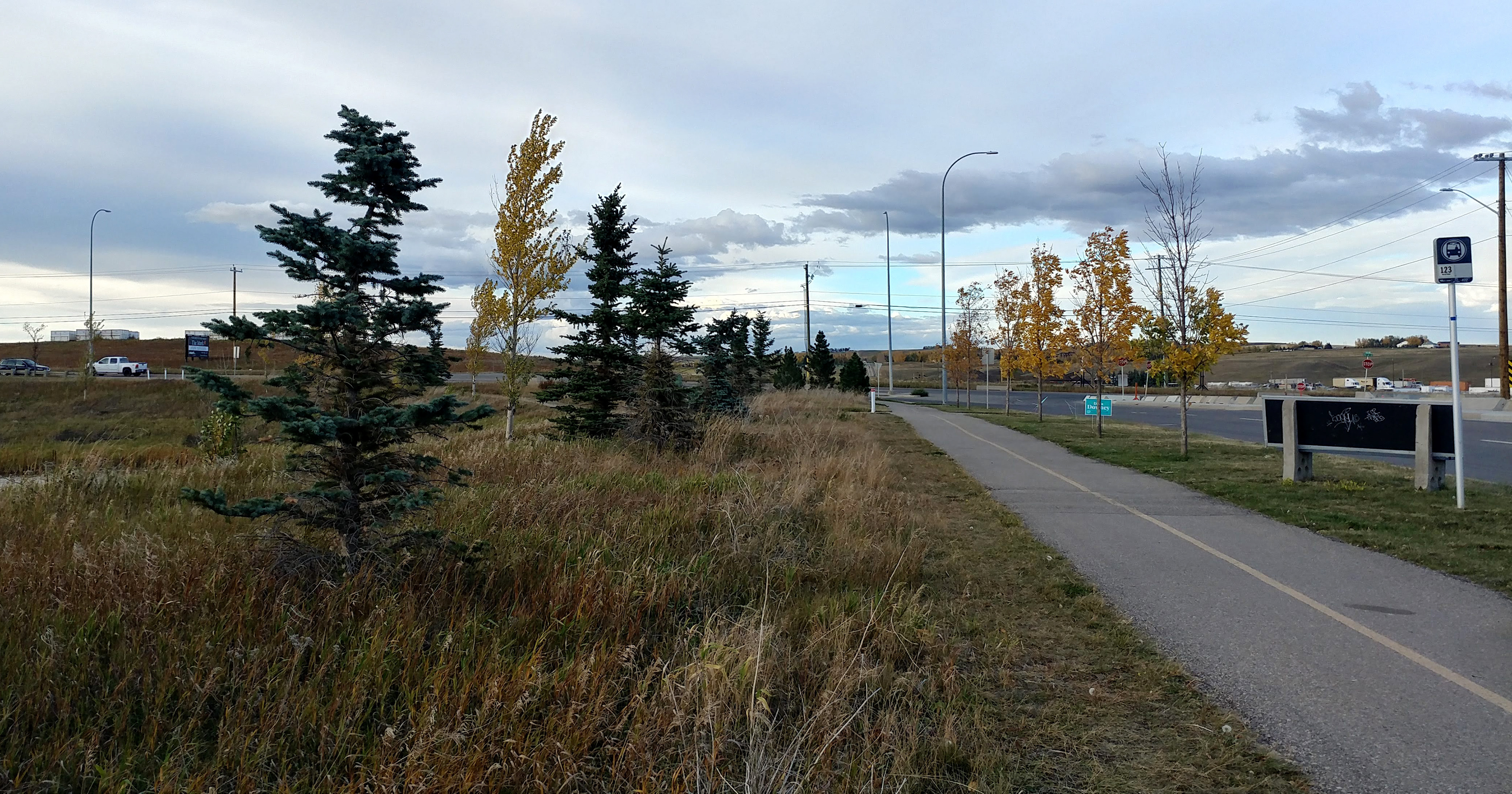
Here is a typical streetscape in Sage Hill.
The "Future School" field in Sage Hill.
MANICURED GRASS
Covers more than 80 hectares.
Consists of various perennial grasses and invasive weeds.

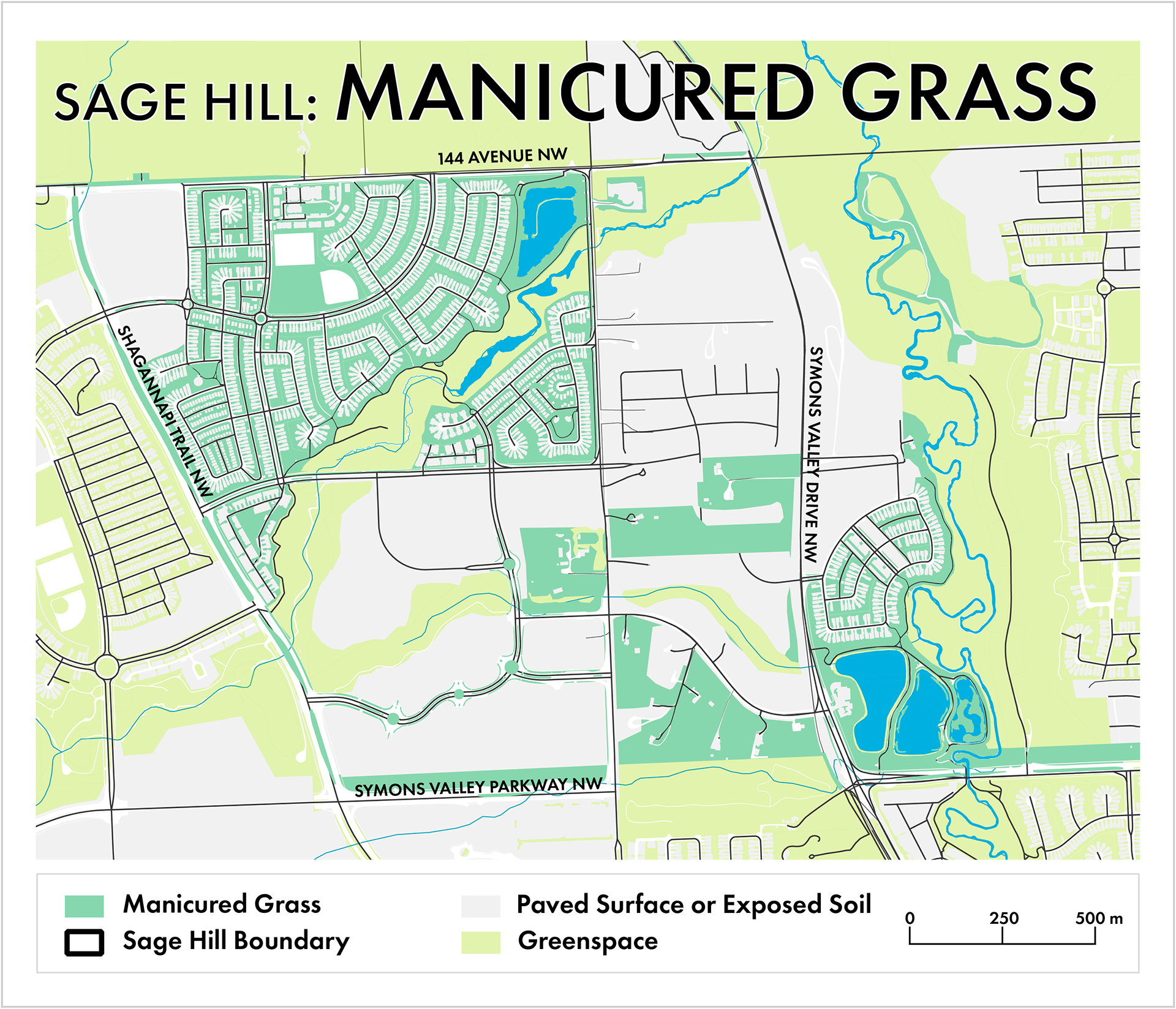
 The community features manicured grass on boulevards, surrounding playgrounds, and in residential yards. DATA FROM CALGARY OPEN DATA PORTAL

REGULATING SERVICES 
Turf grass regions help with water retention by allowing rainwater to better infiltrate the soil compared to paved surfaces (Gómez-Baggethun & Barton, 2013). 
Roots of grass help hold soil in place and reduce erosion (Monteiro, 2017). 
SUPPORTING SERVICES
Serves as a food source for White Tailed Jackrabbits (Lepus townsendii) and various insects. 
Grasses also contribute to soil building, which is another carbon sequestration method (Monteiro, 2017).
CULTURAL SERVICES
Wide open turf spaces allow recreation and community building. The future-school yard hosts dance classes, workout groups, food truck events, a seasonal skating rink, and other neighbourhood organized events. 
Manicured grass surrounds community playgrounds, which provide recreation, a sense of community, and positive feeling of being close to nature (Chiesura, 2004).
DISSERVICES 
There are costs associated with maintaining turf grass, including aerating, mowing and weed removal. Coupled with monetary costs are emissions required to run equipment (Keeler et al., 2019). 
Fields with invasive weeds contribute to more weeds in private yards. Excessive weeds on public properties are a nuisance for homeowners.
CLIMATE MITIGATION 
Grass has a lower albedo than paved surfaces, this allows more of the Sun’s energy to be reflected away from the earth instead of absorbed and trapping heat. Evapotranspiration potential from grass also contributes to lower localized temperatures (Monteiro, 2017).
POTENTIAL THREATS
Removing noxious weeds can require harsh biocides that can be harmful to insects, wildlife, and humans.
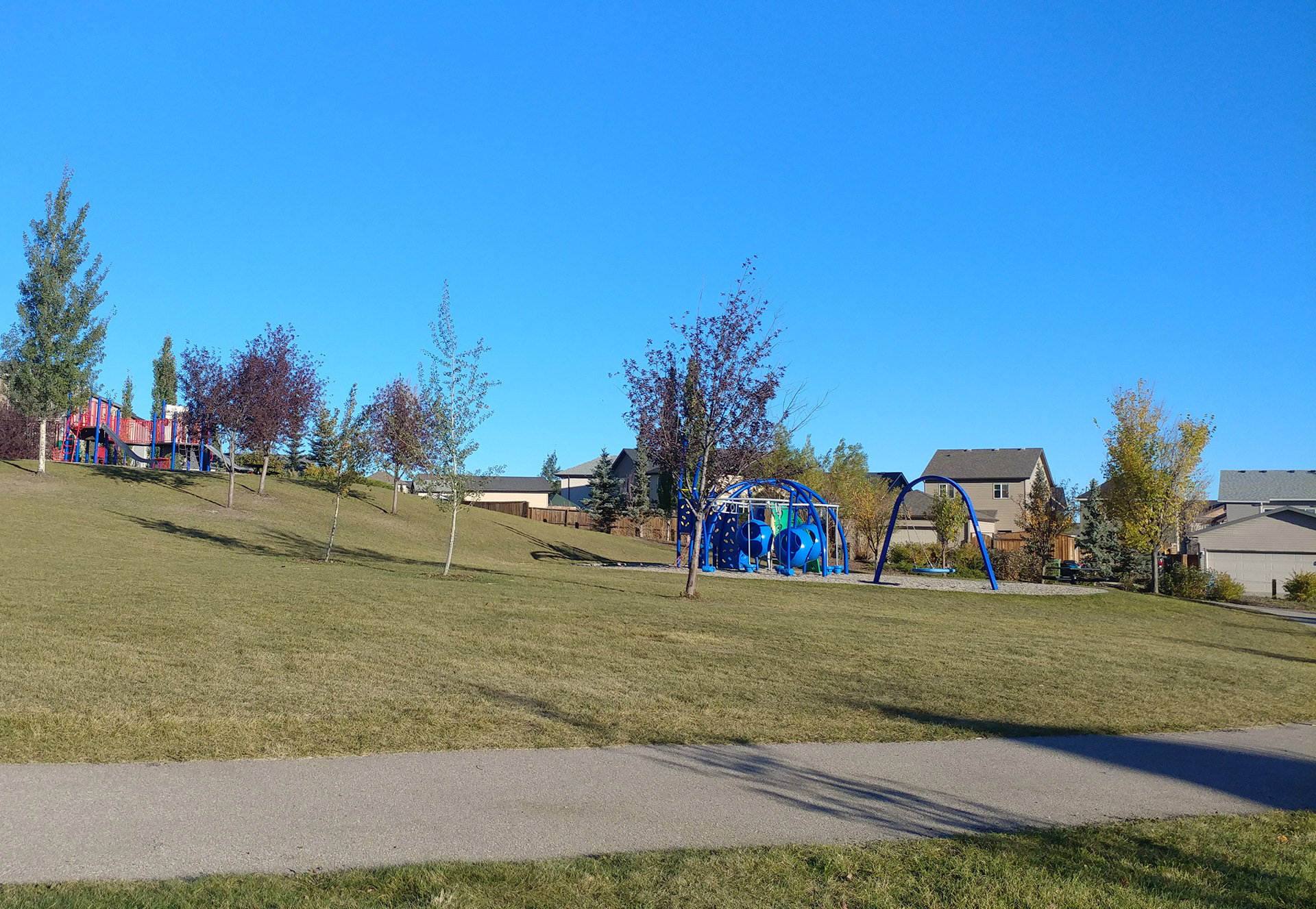
One of the many playgrounds with manicured grass.
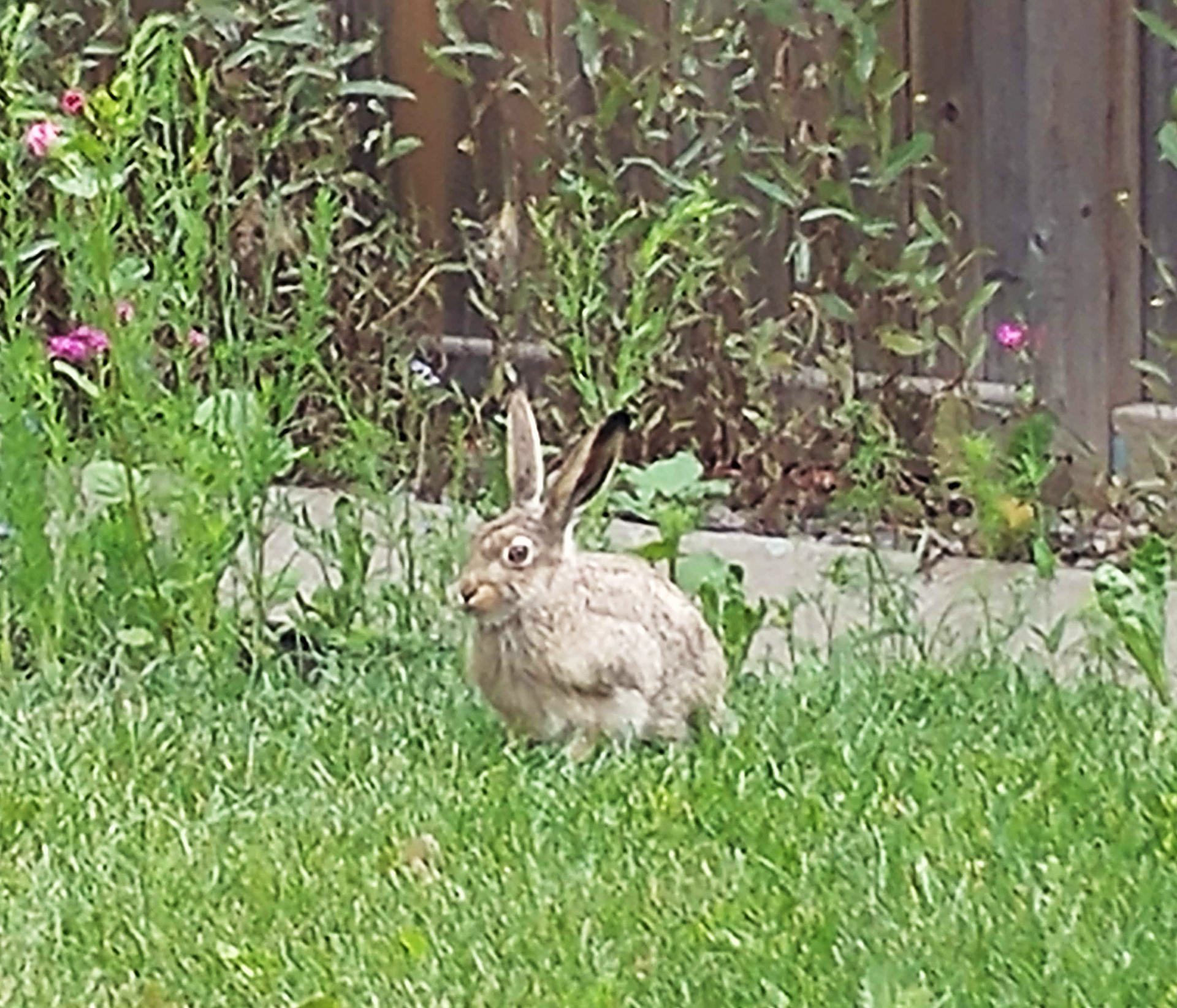
A local hare.
A local hare.
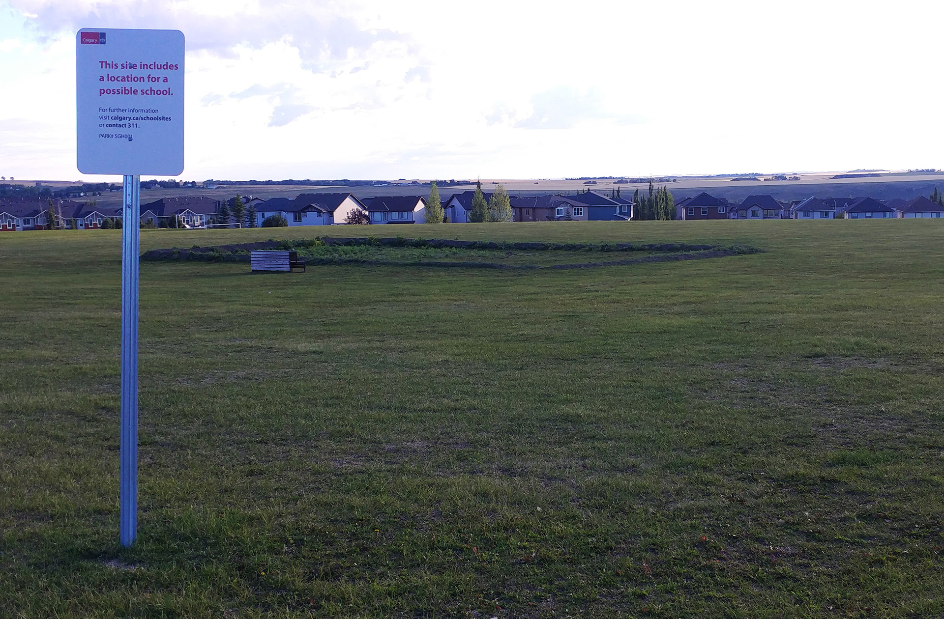
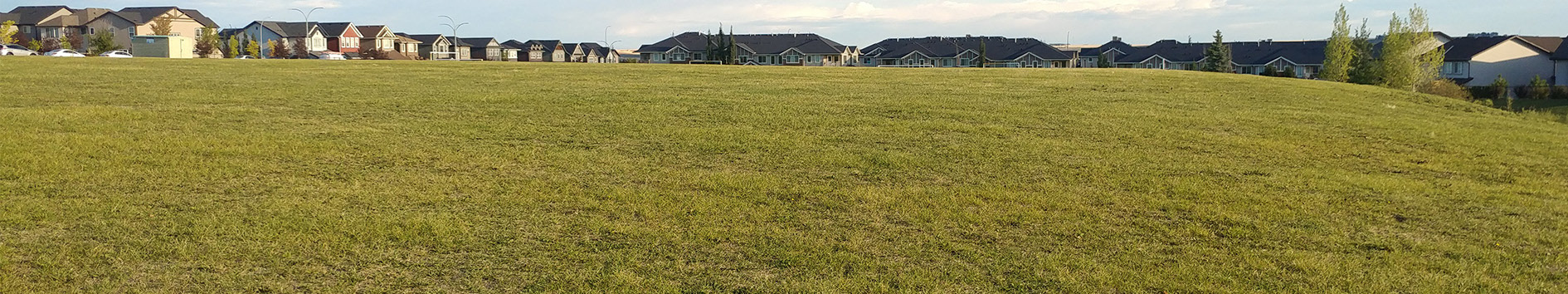
The "Future School" area.
Grassland covered ravine in Sage Hill.
Grassland
Covers over 93 hectares.
Consists of a rich mixture of flowering plants,
a variety grasses, and small bushes.

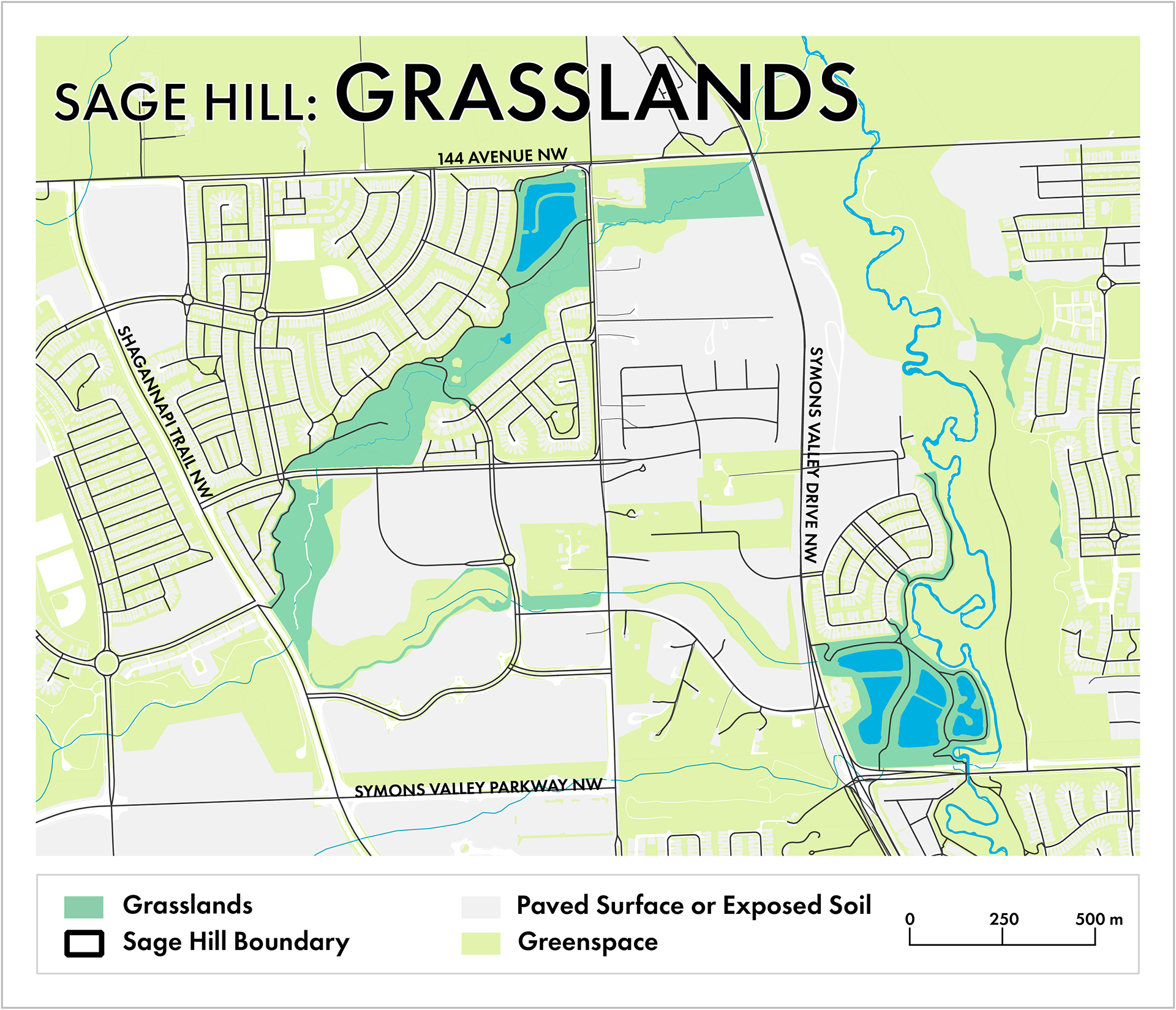
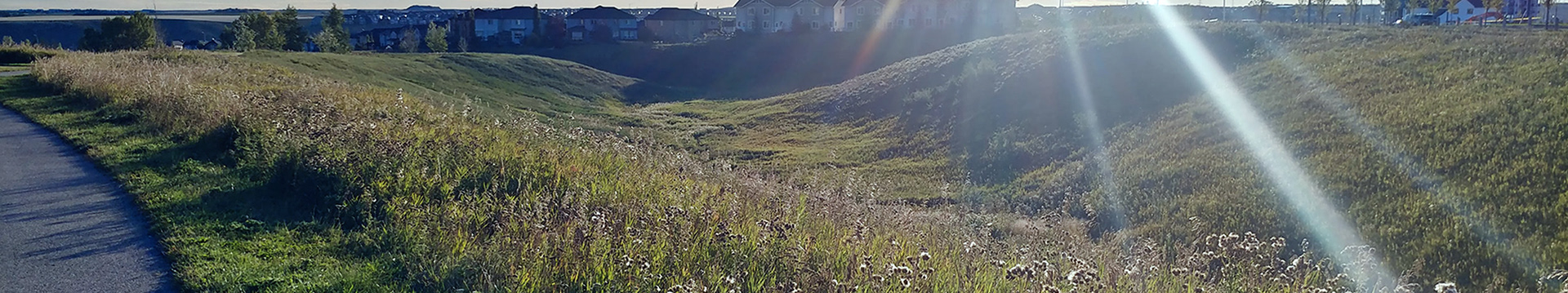
The grasslands surround the multi-use pathways and storm ponds. DATA FROM CALGARY OPEN DATA PORTAL

REGULATING SERVICES 
Water infiltration and purification processes occur when rain water travels through the grassland ravines before entering storm ponds. These two features work in conjunction to minimize pollutants that enter the water system (Keeler et al., 2019). 
Biodiversity is retained through the large variety of species encountered in this space. With over 30 plant species observed, the diversity allows for greater resilience in landscapes. Abundant species include common yarrow (Achillea millefolium), thistle varieties (Cirsium spp.) and sage varieties (Artemisia spp.). 
Erosion control is managed through the root systems of various plants (Monteiro, 2017). 
SUPPORTING SERVICES 
Habitat for pollinators helps flowers to reseed. Animal, wind, and human contact contributes to seed dispersal for plants (Gómez-Baggethun & Barton, 2013). Rich habitat for coyotes (Canis latrans), Richardson’s ground squirrel (Urocitellus richardsonii), skunks (Mephitis mephitis), meadow voles (Microtus pennsylvanicus), gray partridge (Perdix perdix), among others.
CULTURAL SERVICES 
Multiuse pathways in the region follow the landscape of the ravines, allowing for animal sightings and the sounds of nature to improve people’s mental well-being and provide recreation (Chiesura, 2004).
DISSERVICES 
Both flora and fauna contained can be considered nuisance species, such as coyotes and invasive noxious weeds (Keeler et al., 2019). 
Grasses can pose as a fire risk during very dry seasons, and some may consider it an eyesore (Keeler et al., 2019)
CLIMATE MITIGATION 
Various plant life in the coulees allow for carbon sequestration, by using photosynthesis to fix carbon into their structures. The untouched nature of naturalized grassland allows plant matter to build up and incorporate more carbon into the soil (Monteiro, 2017). 
Erosion control and water retention can help mitigate damages caused by extreme weather events (Gómez-Baggethun & Barton, 2013).
POTENTIAL THREATS 
Homeowners adjacent to the greenspace sometimes mow wild areas or dump waste.
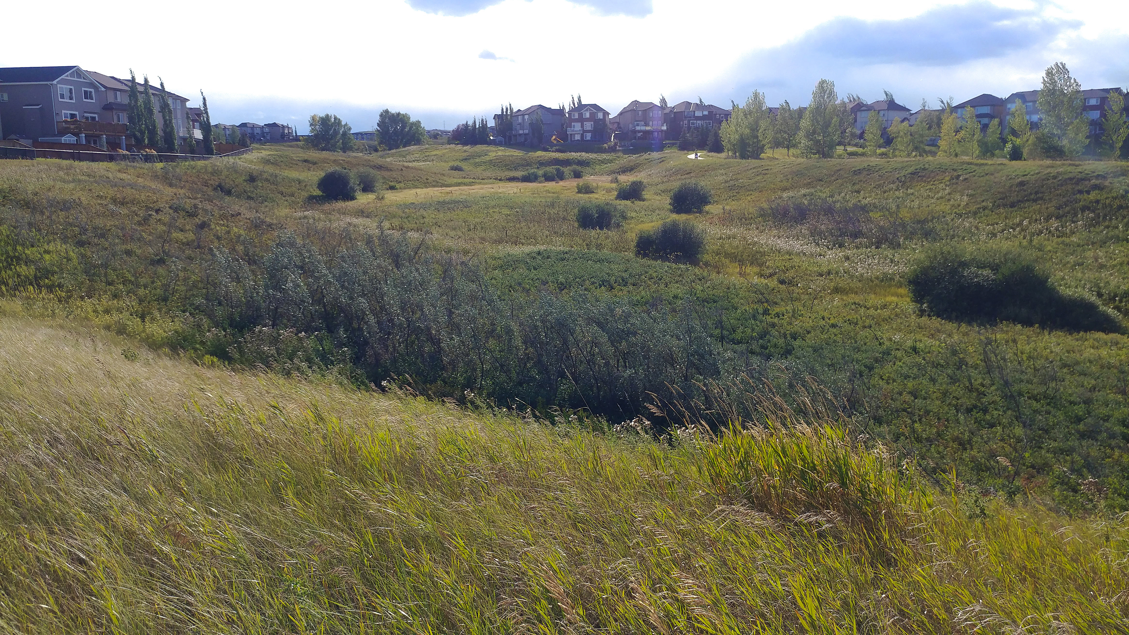
The ravines have naturally growing foliage.
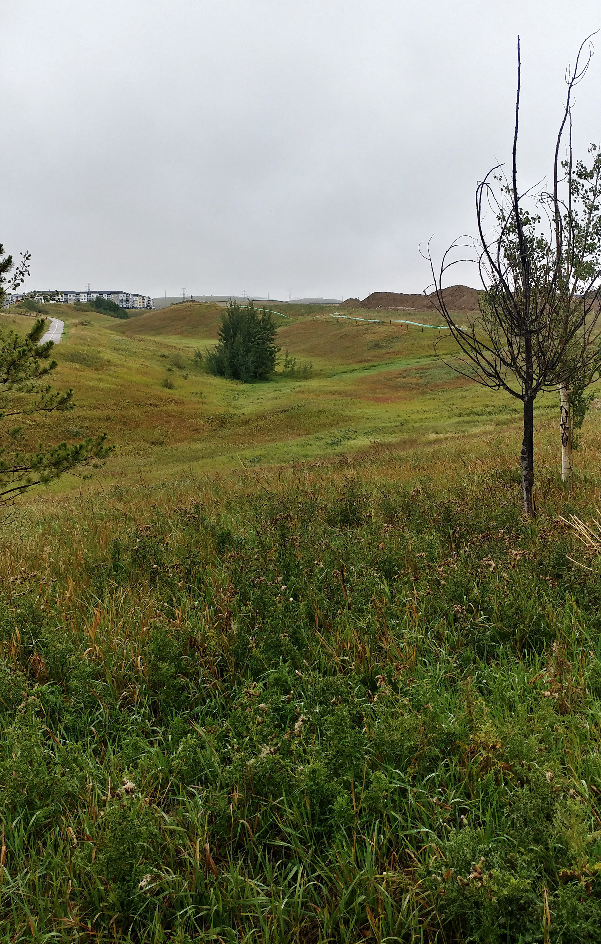
Grass and bushes change colour in the autumn.
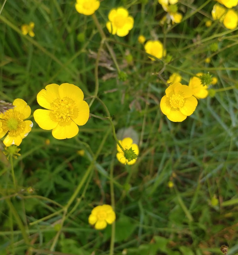
Yellow buttercup flowers that flourish in the grasslands.
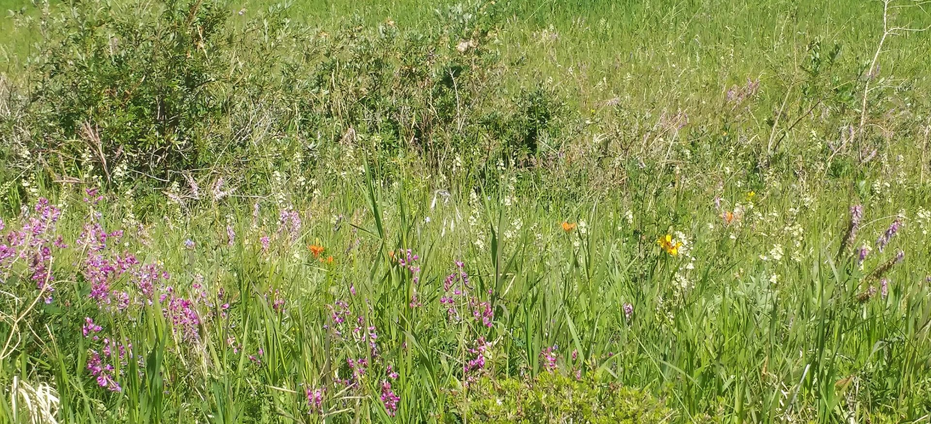
A variety of wildflowers growing in the untouched grassland area in Sage Hill.
Outlook
The community of Sage Hill has robust natural infrastructure that will improve with time. Street trees are young, with proper maintenance they will grow and contribute more to carbon sequestration and air purification. Many natural features were maintained while developing Sage Hill. The natural ravines, creeks, and streams provide many benefits, including increased property values and ecosystem continuity for wildlife. Future work in Sage Hill should focus on maintaining and enhancing natural features like the ravines and their plant life. 
A place for improvement is to eliminate areas of manicured grass to replace them with naturalized grasslands. Increasing the biomass of the plants also provides a bigger reservoir for carbon sequestration. Unmown grass provides more ecosystem services, and more wildlife habitat than that of turf lawns. Reserving some areas for recreation, such as the future school yard, will continue to provide mental health benefits for the community. 
Rewilding boulevards or other hard to get to areas has the benefit of reducing municipal maintenance costs while increasing ecosystem services. This should include public awareness campaigns to stop homeowners from mowing wild grassland on city property, illegally planting or cutting trees, and limiting harsh chemical biocides. 
Close attention must be paid to impacts of future development north of the community. The Glacier Ridge Area Structural Plan specifies the need to preserve West Nose Creek’s riparian zone (City of Calgary, 2015). This area is important to Sage Hill as well. Bridging the two areas so that habitat patches remain unbroken will benefit Sage Hill, Glacier Ridge and all downstream communities. New construction leads to heavier traffic which then increases noise and air pollution. Proper care and monitoring of current natural infrastructure is critical to ensure new communities do not negatively impact existing communities.
Suggestions TO
DECISION MAKERS

1. Naturalize difficult to mow areas
Reduces maintenance cost.
Enhances ecosystem services.
Increases carbon uptake
2. Public outreach to stop
mowing natural grassland
Enhance ecosystem services.
Reduce threat to wildlife.
3. Maintain and protect street trees
Increase carbon uptake over time.
Enhance wildlife habitat
4. Manage invasive weeds mechanically
Reduce pollutant load in the storm ponds.
Reduce threat to wildlife and humans.
5. Community lead garbage clean up events
Reduce pollutant load. Protect wildlife.
Build community pride.
References
Bain, J., Flanagan, J., & Kuijt, J. (2014). Common Coulee Plants of Southern Alberta (Second). University of Lethbridge Herbarium.

Belaire, J. A., Whelan, C. J., & Minor, E. S. (2014). Having our yards and sharing them too: The collective effects of yards on native bird species in an urban landscape. Ecological Applications, 24(8), 2132–2143. https://doi.org/10.1890/13-2259.1

Chiesura, A. (2004). The role of urban parks for the sustainable city. Landscape and Urban Planning, 68(1), 129–138. https://doi.org/10.1016/j.landurbplan.2003.08.003

City of Calgary. (2015). Glacier Ridge Area Structure Plan. Local Area Planning and Implementation – North, Planning, Development & Assessment.

Cormack, R. G. H. (1967). Wild Flowers of Alberta. The Queen’s Printer, Edmonton.
Gómez-Baggethun, E., & Barton, D. N. (2013). Classifying and valuing ecosystem services for urban planning. Ecological Economics, 86, 235–245. https://doi.org/10.1016/j.ecolecon.2012.08.019

Keeler, B. L., Hamel, P., McPhearson, T., Hamann, M. H., Donahue, M. L., Meza Prado, K. A., Arkema, K. K., Bratman, G. N., Brauman, K. A., Finlay, J. C., Guerry, A. D., Hobbie, S. E., Johnson, J. A., MacDonald, G. K., McDonald, R. I., Neverisky, N., & Wood, S. A. (2019). Social-ecological and technological factors moderate the value of urban nature. Nature Sustainability, 2(1), 29–38. https://doi.org/10.1038/s41893-018-0202-1

Millennium Ecosystem Assessment. (2005). Ecosystems and Human Wellbeing. In Assessment of Climate Change in the Southwest United States: A Report Prepared for the National Climate Assessment.

Monteiro, J. A. (2017). Ecosystem services from turfgrass landscapes. Urban Forestry and Urban Greening, 26(April 2016), 151–157. https://doi.org/10.1016/j.ufug.2017.04.001

Salmond, J. A., Tadaki, M., Vardoulakis, S., Arbuthnott, K., Coutts, A., Demuzere, M., Dirks, K. N., Heaviside, C., Lim, S., MacIntyre, H., McInnes, R. N., & Wheeler, B. W. (2016). Health and climate related ecosystem services provided by street trees in the urban environment. Environmental Health: A Global Access Science Source, 15(Suppl 1).  https://doi.org/10.1186/s12940-016-0103-6
Back to Top